
Finding an Anaheim Street by Address
A street-by-street Anaheim search works best as a chain of small checks. Begin with the exact address in Anaheim Property Info or the Orange County Treasurer-Tax Collector search. Record the APN, legal description, ZIP, annexation date, and any map or district fields. The APN is the stable bridge to the county roll. It keeps a name search from drifting to a nearby parcel with a similar street number.
Next, take the APN to the fuller Assessor route, then use the named owner as a grantor or grantee in RecorderWorks. Add permit and directory evidence only after the parcel is anchored. A voter status check is individualized and purpose-limited, so it is not a tool for browsing every address along a street.
- Search the address and select the correct Anaheim parcel.
- Write down the APN, situs address, legal description, ZIP, and annexation field.
- Use the Assessor counter or written route for fuller owner and mailing fields.
- Search the owner as grantee, then move from each grantor to the prior grantee.
- Check permits, city files, directories, and newspapers for a dated address or occupant clue.
Anaheim Street Records, Layer by Layer
The street directory sources do not answer the same question. Anaheim GIS supplies parcel shape and planning context. The tax search converts an address to an APN and tax-statement view. The Assessor can supply fuller roll fields through a counter or written request. RecorderWorks connects named parties to recorded instruments from 1982 forward. Building permits show work and contractor clues, while the Heritage Center's reverse directories can place a listed occupant at an older address.
| Record set | Keeper | Street clue | Access limit |
|---|---|---|---|
| Parcel and GIS | City of Anaheim | APN, legal data, ZIP, districts, layers | Free map; no verified owner-name field |
| Tax statement | OC Treasurer-Tax Collector | Address-to-APN and payment context | Name may lag a sale |
| Assessment roll | Orange County Assessor | Owner, mailing address, value, exemptions | Owner suppressed in free web result |
| Recorded instruments | OC Clerk-Recorder | Grantor, grantee, date, type, instrument | No street search or web image |
| Permits and city files | Anaheim departments | Address, work, applicant, contractor, notices | Date window or request needed |
| Reverse directories | Anaheim Heritage Center | Historical listed occupant or business | Exact years need staff confirmation |
A street directory result is strongest when the same APN, address, date, or legal description links more than one row. Keep the physical situs apart from the owner's mailing address. A tax bill is a clue, not a resident roster, and a permit applicant is not automatically an occupant.
The Orange County Treasurer-Tax Collector search is the address-to-APN bridge for a tax statement and parcel context.
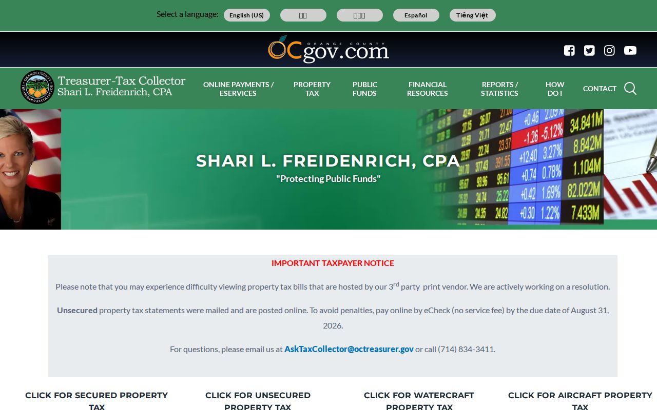
The tax-search image belongs to the parcel layer. It can narrow an address trail without turning a tax statement into a current resident list.
Anaheim Parcel Map Layers
The Anaheim Property Info application lets a researcher search an address, select a parcel, zoom along a street, and turn layers on or off. The useful layers include parcels, address points, zoning, General Plan land use, ZIP Codes, council and school districts, flood hazards, historic districts, overlay zones, development areas, inspection areas, and Accela building permits. The map is informational, not a legal survey.
The parcel layer exposes APN and display APN, house number and subnumber, direction, street, city, and legal-description fields. It supports spatial and distance queries with a 2,000-record maximum, but the public interface does not verify a one-click radius or buffer tool. For a normal street directory, pan and click each adjoining lot instead of assuming a radius feature exists.
| GIS control | Use in an Anaheim street search |
|---|---|
| Address search | Locate the physical address and select its parcel. |
| Parcel or APN | Open the polygon and preserve the APN and legal data. |
| Layer list | Compare ZIP, zoning, land use, flood, historic, district, and permit context. |
| Map browse | Pan along the street and click adjacent polygons one by one. |
Open the Anaheim Parcel Information viewer for the address-to-parcel start. Its map fields make the street directory more precise without claiming that the map itself identifies every person.
Adjacent Anaheim Lots Without a Radius Guess
For a block or a short street segment, use a repeatable adjacent-parcel method. Search the target address, select the polygon, zoom until outlines and address points are clear, and pan along the street. Click each adjoining parcel. Record its APN, situs, ZIP, land use, district, and permit fields before moving to the next lot.
If owner evidence is needed, take each APN to the Assessor counter or written-record route. Do not infer an owner from a mailing address, a stale tax bill, or a map label. The GIS annexation-date field can also explain why an older source uses a county or neighboring-jurisdiction label for a parcel that is now in Anaheim.
- Open the target parcel in the Anaheim GIS viewer.
- Pan to the first adjoining lot and record its parcel and address fields.
- Repeat around the block face, keeping each APN in a separate row.
- Compare ZIP, city-boundary, zoning, historic, flood, and council-district layers.
- Use the Assessor, RecorderWorks, or permit route only after the parcel row is stable.
Note: The parcel layer supports spatial queries, but a public end-user radius button was not verified, so adjacent clicking is the safer documented method.
Anaheim Address to Deed Search
RecorderWorks has no street-address search. Resolve the street address to an APN or legal description, obtain the fuller owner field through the Assessor route, and then search the named person as a grantee. Narrow the date and document type. The acquisition deed identifies the earlier grantor, recording date, and instrument number. Search that grantor as the next grantee in an earlier period.
This is the core address-to-title sequence: street address to APN, APN to owner, owner to grantee, grantee to grantor, grantor to prior deed. The chain is about title parties. It does not establish every resident, renter, or household member. For a pre-1982 deed, use book and page information and ask the Archives about the historical index bridge.
- Situs address
- The physical location of the parcel being studied.
- Mailing address
- The destination for assessment notices, which may be elsewhere.
- Legal description
- The tract, lot, or other land description used apart from a street label.
- Chain of title
- A sequence of recorded transfers that links later and earlier title parties.
The Orange County deed index is free to search from 1982 onward. Copies are ordered separately, and online document images are not part of the index.
Search Anaheim Building Permits by Date
Anaheim's issued and finaled permit report is address-keyed but date-driven. Choose the milestone, set a date range of no more than ten years, apply the change, and export the displayed table to CSV. Results can include permit number and status, address, description, received/issued/final dates, parcel number, residential or commercial category, job valuation, owner-builder flag, plan-check status, work type, contractor name, and contractor phone.
For a street directory, export a legally sized time range and filter the CSV for the street. A permit is evidence of work, not proof of residence. If the underlying file is needed, give the city the address, permit or project number, and date range. The city portal or a CPRA request can lead to the file. Code-enforcement records use a separate request form and may include complaints, notices, photographs, violation letters, and civil citations, subject to exemptions.
See the Anaheim issued-permit report before starting a broader street search.
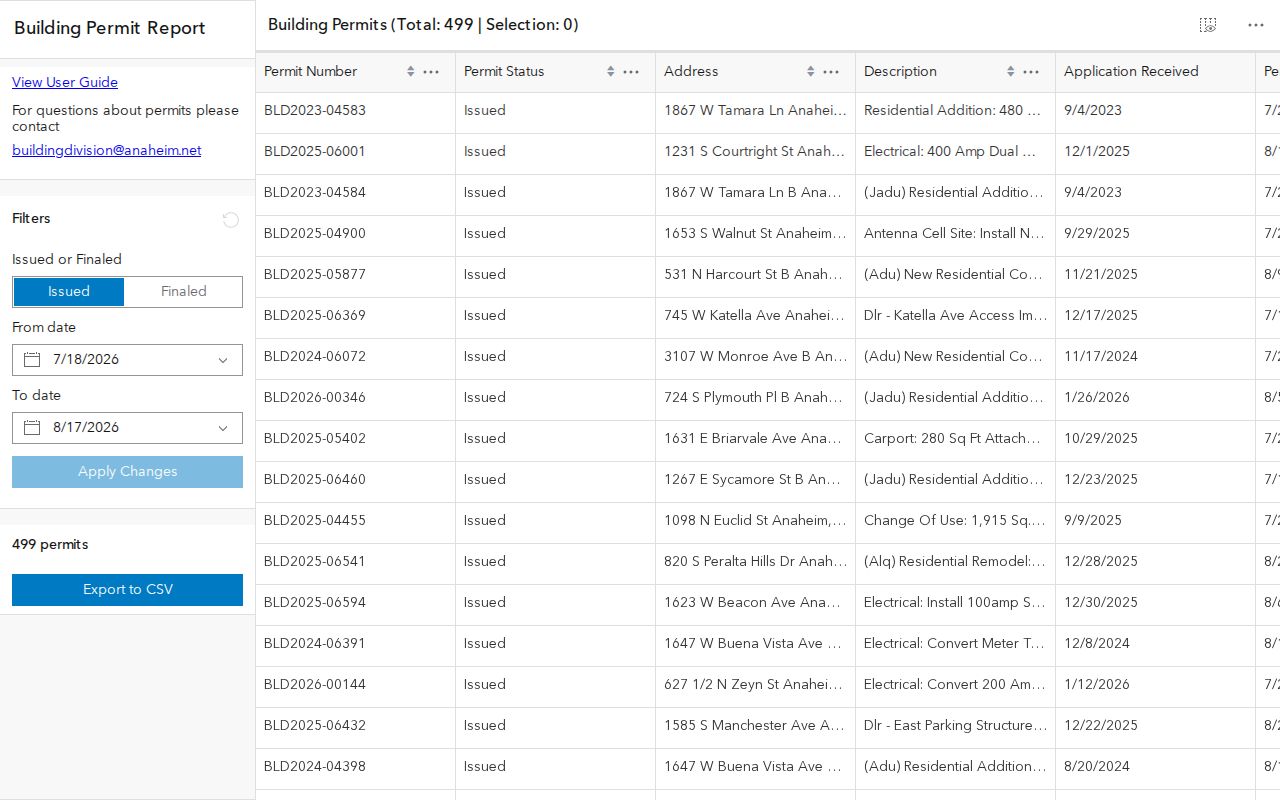
The permit screen is a good example of an address record that adds dates and work detail without turning an applicant or contractor into a household match.
Code-Enforcement Records at One Anaheim Address
A specific address can be used on Anaheim's code-enforcement form to request a service complaint, notice, documentation, notice-of-violation letter, photograph, or civil citation. The form also asks for the requester's contact details, an approximate month and year range, a court date when relevant, delivery choice, and signature. A defined address and time window gives staff a workable file target.
The Planning and Building Department lists a ten-working-day reply and page charges of $0.15 for standard monochrome copies and $0.20 for color copies. Complainant identity and other personal details may be withheld under a CPRA exemption or safety interest. A street directory should report the record category and its access limit, not repeat protected details or imply that a complaint proves wrongdoing.
Address clue. A code file can connect a parcel to a dated notice or project history. It is a municipal record about an issue, not a household list.
Use the Anaheim code-enforcement request form when the public portal does not expose the record category needed.
Old Anaheim Street Names Break Searches
Anaheim's street grid carries names from several address eras. George Hansen's original Colony centered on Center Street and Los Angeles Street. Center Street is now Lincoln Avenue, and Los Angeles Street is now Anaheim Boulevard. Pacifico Street became Gene Autry Way in 1991. A historical street directory search that uses only the current name can miss a deed, newspaper notice, directory entry, or photograph.
Search paired forms when the parcel sits in an old Colony or growth corridor: Center with Lincoln, Los Angeles with Anaheim Boulevard, and Pacifico with Gene Autry Way. The city does not publish a verified citywide house-number renumbering year, so do not invent a number shift. Use the parcel, legal description, tract, or map to test continuity.
Note: Anaheim's annexation-date field can explain why an address appears in county material before it appears in a city permit or planning series.
Read an Anaheim Reverse Directory
Printed reverse or criss-cross directories can turn an address into a listed occupant or business. They are especially useful after a deed identifies a parcel but before a family name is known. The Heritage Center holds Anaheim and Orange County directories, with a physical shelf reported from 1899 to the present. Exact reverse-directory years and publisher runs remain a staff-verification gap.
Read the volume's own abbreviation key first. Record the address, name, occupation or business, spouse or widow notation when present, and any mark that distinguishes a residence from a business. Compare nearby years and use newspapers, census schedules, permits, and deeds to test a change. A directory entry reflects who was listed when the edition was made, not every person at the address.
Historical collection details belong in the Anaheim city directory treatment. The street directory uses the collection as one address clue, then returns to the parcel and custodian trail.
What an Anaheim Street Directory Cannot Show
No public Anaheim street directory lists every household member. Deeds identify title parties. The assessment roll distinguishes owner and mailing fields. Permits identify project participants. Reverse directories show listed names at a past time. DMV address data is restricted, utilities are not a public roster, and a voter file cannot be used as a casual commercial street list. Protected residents may use Safe at Home to keep a substitute address in public systems.
Use address records for lawful personal research, family history, property curiosity, civic records, and safety awareness. Do not use a street result to stalk, harass, intimidate, or harm anyone. When a person is not shown, the absence may reflect a lawful access rule, an unlisted household, a changed name, or a record that belongs to another custodian.
Lawful use. Anaheim address records can support a legitimate personal question, but they are not a license to monitor or threaten a person. Stop at privacy and custodian limits.
For one identified person, shift to the Anaheim resident lookup workflow rather than widening the street search without a lawful, defined purpose.